Severe Weather Could Bring Heavy Rain and 60 MPH Winds to Mid Michigan Today
Much of Michigan's Lower Peninsula could see severe weather and strong wind gusts later this afternoon. (Tues. 9/7)

After a calm and delightful Labor Day weekend that only brought a few intermittent showers to the Mid-Michigan area, our first day after Labor Day is starting out as a gorgeous, comfortable day. But that will probably change quickly.
Two Weather Models are in Agreement
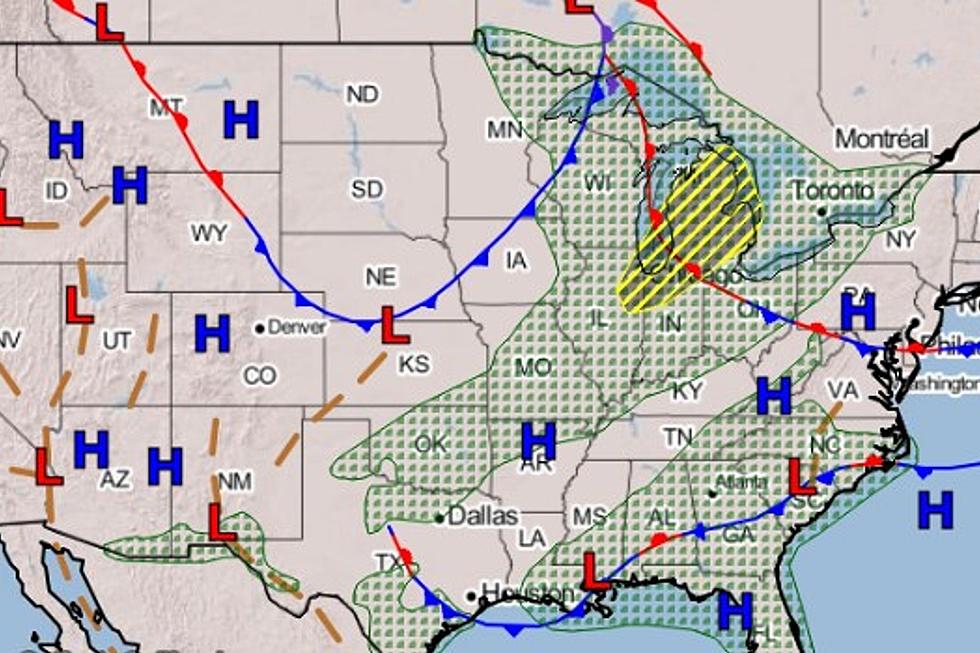
A line of potentially severe thunderstorms is expected to move from the northwest to the southeast across Michigan's Lower Peninsula. Note the above graphic from the National Weather Service. Our news partners at Mid-Michigan Now say that two weather models are in agreement that the line of showers could potentially bring heavy rain and strong winds to those of us below the Mackinac Bridge.
Timing Out the Threat of Severe Weather
Folks who live 'up north' (West Branch, Gladwin, Tawas, etc.) may start to see severe weather in the early afternoon, somewhere around 2 pm.
As the system progresses, residents in the Bay City/Saginaw Bay area will see the impact of the storms next, and it could then reach the Flint area in the early evenening hours, probably after 5 pm.
Our area should then be clear of any severe weather after 10 pm, as the storm then moves on to the Metro Detroit area.
What to Expect
The impact of the storm could mean heavy rain and isolated flooding, especially in low lying areas. Wind gusts up to 60 miles per hour are possible, as is hail up to one inch in diameter.
WNEM-TV in Saginaw also reports that the possibility of an isolated tornado cannot be ruled out.
Make sure you're weather aware this afternoon and evening and be ready to take shelter if necessary.
SEE MORE: Photos of the Bursting of Edenville Dam in Midland County
LOOK: The most expensive weather and climate disasters in recent decades
More From Banana 101.5